Add your own picture and explain the route, parking, gates, paths or landmarks that help people find it.
Earn 5 points after the picture is checked and accepted.
Add your photo and local directionsShare what you foundWhat is recorded here
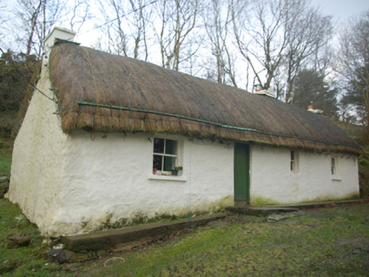
Detached four-bay single-storey vernacular house built c. 1820 and extended to the north-east end. Pitched/domed thatched roof having ropes over ridge secured on pegs at eaves level. Three rendered chimneystacks. Limewashed rubble stone construction, slightly battered to the south-west corner of front elevation (south-east); modern blockwork construction to the rear elevation (north-west) at the north-east end. Square-headed window openings with cut stone sills and two-over-two pane timber sliding sash windows. Square-headed door opening having battened timber door. Set well back from road on sloping site in own grounds to the west of Killybegs. Long approach avenue to house from the south-east. Detached two-bay single-storey outbuilding to south-west, having replacement pitched corrugated-metal roof, limewashed rubble stone walls with recent blockwork repairs, square-headed window opening with battened timber shutter and square-headed door opening with replacement timber battened door. Ruins of earlier dry stone house to rear of main building.
This official record and map point do not grant access. Most recorded buildings are privately owned; view them only from public ground unless the owner allows entry.