Add your own picture and explain the route, parking, gates, paths or landmarks that help people find it.
Earn 5 points after the picture is checked and accepted.
Add your photo and local directionsShare what you foundWhat is recorded here
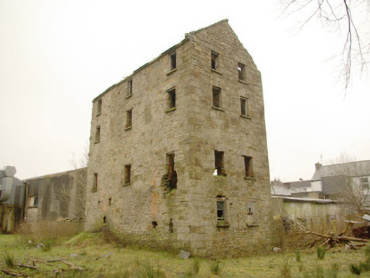
Detached four-bay four-storey former corn and flour mill, built c. 1855. Three-bay to north elevation. Now disused and derelict. Pitched natural slate roof with grey clay ware ridge tiles, projecting cut stone eaves course to north and south elevations and cut stone kneeler stone to gable end at eaves level to the north-west corner. Rendered feature to west side of roofline, probably a chimneystack. Randomly coursed random rubble stone walls with flush dressed block-and-start quoins to the corners. Red brick bricked-up openings to south elevation. Square-headed window openings with squared rubble stone voussoirs over timber lintels, and having the remains of timber sliding sash windows (one-over-one, two-over-two, and six-over-six pane) to some openings. Square-headed door opening to the south elevation having cut stone plinth blocks to base, squared rubble stone voussoirs over timber lintels, and remains of timber door. Set back from road in own grounds to the east of Donegal Town centre, a short distance to the east of Donegal Community Hospital. The Drummeeny River (a tributary of the Rover Eske) flows south-north a short distance to the west of site. Remains of former tailrace to the north-west of site having remains of single-arched stone bridge over to the south end. Headrace to the south now infilled/silted. Former sandstone millwheel to the west of site. Single-storey outbuilding to the south having roughcast rendered walls, mono-pitched corrugated metal roof, and squared-headed openings. Main Donegal to Ballybofey road runs to the south of site.
This official record and map point do not grant access. Most recorded buildings are privately owned; view them only from public ground unless the owner allows entry.