Add your own picture and explain the route, parking, gates, paths or landmarks that help people find it.
Earn 5 points after the picture is checked and accepted.
Add your photo and local directionsShare what you foundWhat is recorded here
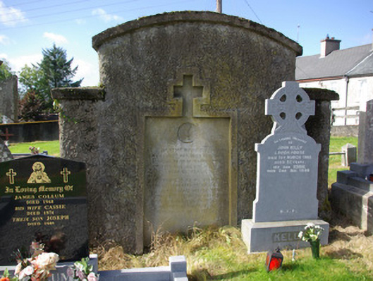
Graveyard (on irregular-plan), originally laid out c. 1820. Formerly also the site of Stranorlar Catholic church, built c. 1820, and demolished c. 1870 following the construction of Church of Mary Immaculate\St. Mary’s Catholic church (see 40838023) to the south-west. Collection of upstanding, recumbent and table-type gravemarkers of mainly late nineteenth and twentieth-century date, some with metal railed enclosures. Site surrounded by roughcast rendered rubble stone walls, exposed rubble stone to the southern boundary. Main gateway to the north of site comprising a pair of squared and coursed rubble stone gate piers (on square-plan) with capstones and a pair of modern metal gates. Located to the north of the centre of Stranorlar, and to north-east of Ballybofey.
This official record and map point do not grant access. Most recorded buildings are privately owned; view them only from public ground unless the owner allows entry.