Add your own picture and explain the route, parking, gates, paths or landmarks that help people find it.
Earn 5 points after the picture is checked and accepted.
Add your photo and local directionsShare what you foundWhat is recorded here
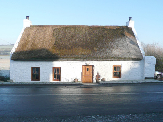
Detached four-bay single-storey with attic level vernacular house, built c. 1800 and renovated c. 2010. Pitched flax thatched roof with decorative knotting to eaves, smooth rendered eaves course, exposed smooth rendered parapets and smooth rendered to gables ends (north-west and south-east). Lime washed rubble stone walls. Square-headed window openings with no sills and replacement timber casement windows. Square-headed doorway, offset to the south-east side of centre, having replacement battened timber double doors. Set in a sunken site adjacent to road to the south-east\south of Ballindrait. Wrought-iron railings to flight of steps down from road level to doorway. Gateway to the east gable end having a pair of lime washed rubble stone entrance piers (on square-plan) having wrought-iron flat bar gate. Enclosed yard to rear.
This official record and map point do not grant access. Most recorded buildings are privately owned; view them only from public ground unless the owner allows entry.