Add your own picture and explain the route, parking, gates, paths or landmarks that help people find it.
Earn 5 points after the picture is checked and accepted.
Add your photo and local directionsShare what you foundWhat is recorded here
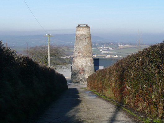
Freestanding six-stage former windmill (on circular-plan), dated 1874(?), having walls tapering from base. Now ruinous (unused since 1932). Ashlar coping over tower having remains of timber rotating sail mechanism over. Rubble stone walls with remnants of lime render over. Cut stone date plaque (on diamond-plan) to second stage having Masonic square and divider motif to head and text reading ‘Erected 1874(?) Charles Robinson(?)’. Projecting timber trusses\supports around tower at third stage level, formerly supporting timber walkway\gantry. Square-headed window openings, doors or loading bays to north having concrete sills red brick surrounds and voussoirs; window fittings now gone. Opening at ground floor level now infilled with brick. Millstones survive to interior at second stage level. Located in farm complex to south of Ballindrait on elevated ground close to summit of Croghan\Croghan Hill. Set in concrete paved yard and surrounded by modern house (to west) and modern or heavily altered outbuildings. Approached via laneway from road to the south.
This official record and map point do not grant access. Most recorded buildings are privately owned; view them only from public ground unless the owner allows entry.