Add your own picture and explain the route, parking, gates, paths or landmarks that help people find it.
Earn 5 points after the picture is checked and accepted.
Add your photo and local directionsShare what you foundWhat is recorded here
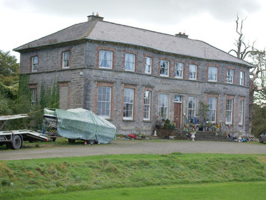
Detached nine-bay two-storey over basement (to rear) county house, built c. 1806-7, having full-height three-bay shallow bowed projections to either end of the main elevation (west) and with remains of single-bay single-storey structure to the centre of the rear elevation (west). Damaged by fire to interior in 1971 and re-roofed c. 1990. Hipped slate roof (added c. 1990), having central valley, wide overhanging eaves with projecting sandstone eaves course with paired cut stone brackets/modillions, some surviving sections of cast-iron rainwater goods, and with two rendered chimneystacks. Curved sections of roof over shallow bowed projections to front elevation. Irregularly coursed and squared rubble stone walls with flush quoins to the corners; projecting cut stone stringcourse/plinth course at ground floor level. Square-headed window openings with flush red brick block-and-start surrounds, cut stone sills, and with six-over-six pane timber sliding sash windows at ground floor level and three-over-three pane timber sliding sash windows at first floor level. Continuous cut stone sill course to main elevation at first floor level and cut stone entablatures supported on cut stone console brackets to ground floor window openings. Square-headed window openings to rear elevation with timber sliding sash windows; square-headed window openings to rear and side elevations at basement level having rubble stone voussoirs over and with wrought-iron security bars. Central square-headed doorway to main elevation having plain ashlar surround, replacement timber door, plain overlight; square-headed window openings to either side of doorway having plain cut stone surrounds and timber sliding sash windows. Doorway reached up flight of cut stone steps giving access to raised cut stone platform; steps and platform flanked by wrought-iron railings. Set well back from road in extensive mature wooded and parkland grounds a short distance to the west/south-west of Convoy. Deale River flows west to east to the south of the house and demesne. Main entrance gates with castellated gateway and lodge (see 40832003) to the north at start of long approach avenue to house. Remains of extensive complex of single- and two-storey outbuildings to the rear (east) and to the north-east having rubble stone walls, pitched and barrel-shaped slate and corrugated-metal roofs, and square-headed openings. Remains of former horse-powered churning mill to one of the outbuildings. Possible former chapel to the east, now ruinous. Walled garden (on rectangular-plan with bowed wall to the north) to the east having rubble stone boundary walls and integral round-headed doorways with roughly dressed voussoirs and surrounds, remains of rubble stone outbuildings/former greenhouses to the interior of walled garden. Possible remains of former icehouse to the north (not viewed). Site of former house to the north-east.
This official record and map point do not grant access. Most recorded buildings are privately owned; view them only from public ground unless the owner allows entry.