Add your own picture and explain the route, parking, gates, paths or landmarks that help people find it.
Earn 5 points after the picture is checked and accepted.
Add your photo and local directionsShare what you foundWhat is recorded here
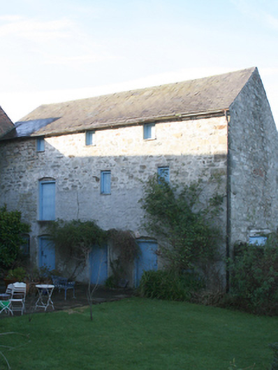
Formerly detached three bay three-storey former warehouse\store, built c. 1860, having gablet to the west elevation. Now out of use\in use as outbuilding. Pitched natural slate roof with projecting cut stone eaves courses, grey clay ware ridge tiles, and cast-iron rainwater goods. Pitched natural slate roof to gablet to the west elevation. Random rubble stone walls with flush roughly squared stone block-and-start quoins to the corners. Section of walling under gablet to the west elevation now infilled with blockwork. Square-headed window openings\loading bays having battened timber shutters, tooled stone lintels and some stone sills. Blocked square-headed window opening to the north elevation at first floor level, now infilled with rubble stone, having red brick voussoirs. Segmental-arch door openings and loading bays to the east elevation having red brick relieving arches and battened timber doors. Altered square-headed carriage-arch to the north elevation having concrete lintel, and modern battened timber double-doors. Set slightly back from road to the north end of the quayside, Ramelton, and to the north-east of the centre of the town. Sections of rubble stone boundary wall adjoining to the east and west; enclosed yard adjacent to the west having rubble stone boundary walls. River Leannan adjacent to the north. Complex of former warehouses\stores adjacent to the west and the south-west (see 40800405 to 40800409).
This official record and map point do not grant access. Most recorded buildings are privately owned; view them only from public ground unless the owner allows entry.