Add your own picture and explain the route, parking, gates, paths or landmarks that help people find it.
Earn 5 points after the picture is checked and accepted.
Add your photo and local directionsShare what you foundWhat is recorded here
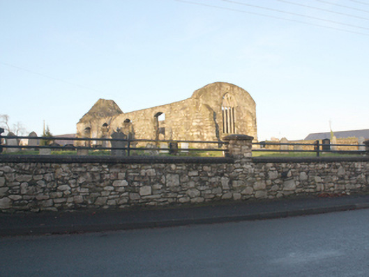
Freestanding single-cell hall-type former Church of Ireland church, built 1619-22. Remained in use until construction of later Church of Ireland church (see 40800505) to the south-west. Now out of use and derelict. Roof now removed\collapsed, formerly pitched with cut stone eaves course to the long elevations. Remains of lower section of a bellcote to the west gable end. Coursed rubble sandstone walls, partially roughcast rendered, with stepped clasping rubble stone buttresses to the corners and to the north elevation. Segmental headed window openings to the south elevation having rubble stone voussoirs; fittings now removed and openings now extended to ground level. Pointed four-light window to the chancel gable (east) having cut stone tracery, cut stone surround, and with cut stone hoodmoulding over; carved Romanesque architectural fragment (RMP DG046-005004-) from church on Aughnish Island c. 1150, incorporated over. Small pointed-arched window opening to the west end of the north elevation, now blocked, having moulded cut stone surround. Roundel opening over doorway to the west gable, now blocked. Round-headed doorway to the west gable having carved sandstone surround with roll moulding, and with modern lintel to head. Set back from road in own grounds to the south of the centre of Ramelton. Graveyard to site (RMP DG046-005006-) with collection of gravemarkers of upstanding, recumbent, and table types dating from the eighteenth century (and probably the seventeenth century) to recent times. Grave off the Stewart family of nearby Fort Stewart (see 40904601) located to the north-east corner of site having decorative cast-iron surround. Site surrounded by coursed rubble and rubble stone boundary walls. Modern railings over boundary wall to the east. Plaque to the east of site reading 'This new piece of ground was municifently given to the public by Sir James Stewart Baronet 1839.Gateway to the north-east corner of site comprising a pair of rubble stone gate piers (on square-plan) having pyramidal coping over, and with a pair of wrought-iron gates.
This official record and map point do not grant access. Most recorded buildings are privately owned; view them only from public ground unless the owner allows entry.