Add your own picture and explain the route, parking, gates, paths or landmarks that help people find it.
Earn 5 points after the picture is checked and accepted.
Add your photo and local directionsShare what you foundWhat is recorded here
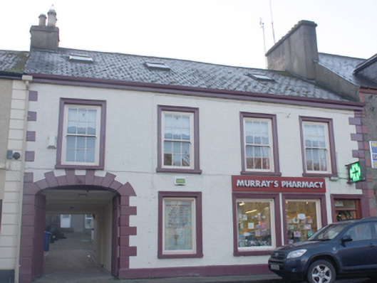
Attached four-bay two-storey house, built c. 1810 and altered c. 1870 and c. 2004, having integral segmental-headed carriage-arch to the east end of the front elevation (north, modern shopfront to the west end of the front elevation, and with central single-bay two-storey return to the rear (south). Altered c. 2004 and now also in use as a pharmacy with modern single- and two-storey extensions to the rear (south). Pitched artificial slate roof with smooth render chimneystacks to either end, terracotta pots to chimneystack to the east, profiled cast-iron gutters, and with modern rooflights. Roughcast rendered walls over smooth rendered plinth course, and with smooth rendered block-and-start quoins to either end. Square-headed window openings at first floor level having stucco architraved surrounds, painted limestone sills, and with six-over-six pane timber sliding sash windows; square-headed window openings at ground floor level having stucco architraved surrounds, painted limestone sills, cast-iron sill guards to openings to the west, and with fixed-pane display windows. Square-headed door opening to west end of façade with replacement glazed timber door and overlight. Segmental-headed carriage-arch archway to east of façade having stucco block-and-start surround, fielded keystone motif, and modern metal gates. Road-fronted to the east end of The Mall, Ramelton, and to the west of the town centre.
This official record and map point do not grant access. Most recorded buildings are privately owned; view them only from public ground unless the owner allows entry.