Add your own picture and explain the route, parking, gates, paths or landmarks that help people find it.
Earn 5 points after the picture is checked and accepted.
Add your photo and local directionsShare what you foundWhat is recorded here
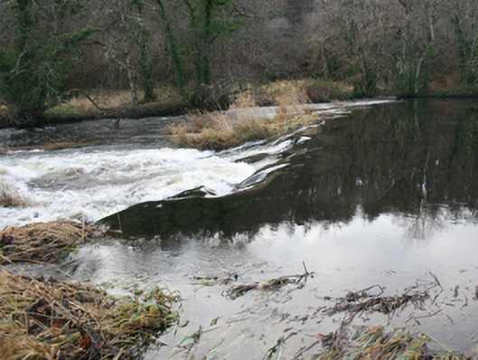
Weir (on curvilinear-plan) spanning the River Leannan, erected c. 1790, and altered c. 1850. Possibly incorporating fabric from earlier weir or weirs to site. Formerly associated with iodine and bleach mills works; later associated with Watt’s Salmon Fishery. Rubble stone construction. Additional weir (on curvilinear-plan) to the east, built c. 1800 and altered c. 1850, having remains of weir mechanism to the centre. Links south bank of River Leannan with island to centre of river; additional section to the north, built c. 1820, and altered c. 1860 and c. 1920, having rectangular sluice (?) structure to the centre with cement rendered rubble stone walls to the north and south elevations, concrete cutwaters and remains of timber sluice mechanism to the west elevation, and with cement rendered brick piers to the east elevation with remains of wrought-iron sluice mechanism. Square-headed doorway to the south linked to island to south by remains of timber footbridge. Additional weir to the north-east, added c. 1860, having rubble stone construction. Located in the rural countryside to the south-west of the centre of Ramelton, and to the south-west, south, and east of former bleaching green, site of former iodine and bleaching works, and later salmon fishery, and to the south of The Green (see 40800305).
This official record and map point do not grant access. Most recorded buildings are privately owned; view them only from public ground unless the owner allows entry.