Add your own picture and explain the route, parking, gates, paths or landmarks that help people find it.
Earn 5 points after the picture is checked and accepted.
Add your photo and local directionsShare what you foundWhat is recorded here
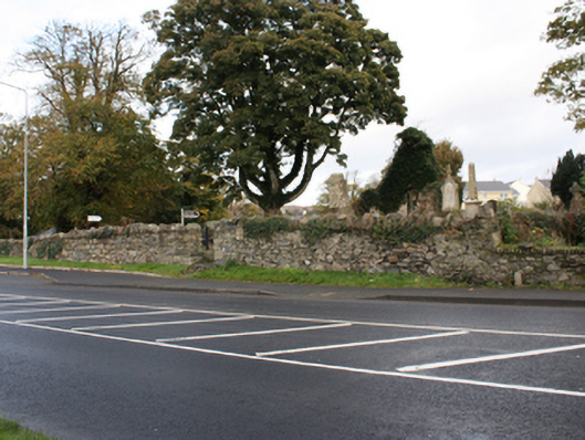
Church of Ireland graveyard (see RMP DG038-013004-) on irregular-plan, laid-out c. 1600, containing a collection of upstanding, recumbent, and table-type gravemarkers dating from the early seventeenth-century into the twentieth century. Metal railed enclosures to some sites. Grave of Agnes Elizabeth Jones (1832-68) to west of site comprising table-type stone memorial having railed enclosure comprising decorative cast-iron gate posts with pinnacle finials over, and with hooped wrought-iron railings. Ruins of former Church of Ireland church (see RMP DG038-013001-) to site, built c. 1600, with only east gable end and short sections of north and south elevations now standing above ground having partially rendered rubble stone walls, now largely covered in ivy, with antae like projections to the east gable end, and with triple-light round-headed window to the east gable having cut stone intersecting\double Y-tracery. Cut stone wall plaque to Hawkshaw family beneath window opening. Built on site of earlier ecclesiastic foundation founded in the late sixth century by St. Columbkille. Seventh to tenth century (suggested dates vary) cut stone cross-slab, St. Mura’s Cross (see RMP DG038-013002-), to the north-west of church having ‘pitched’ head, interlaced ribbon decorative Celtic cross detail to both faces, and with carved figures. Gateway to the south-west corner of site having wrought-iron pedestrian gate. Gateway flanked to the south by reused cut stone slab (see RMP DG038-013003-) with a carved Celtic cross motif and to the north by a perforated round stone (see RMP DG038-013007-). Rubble stone boundary wall surrounding site having soldier coursed rubble stone coping, and with wrought-iron gates. Located to the south-east end of Fahan. Later Church of Ireland church (see 40820014) adjacent to the north-west.
This official record and map point do not grant access. Most recorded buildings are privately owned; view them only from public ground unless the owner allows entry.