Add your own picture and explain the route, parking, gates, paths or landmarks that help people find it.
Earn 5 points after the picture is checked and accepted.
Add your photo and local directionsShare what you foundWhat is recorded here
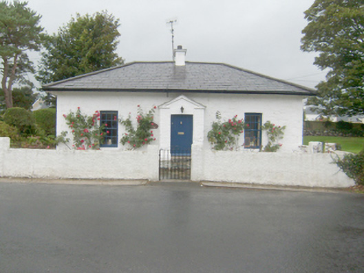
Detached three-bay single storey with converted attic level gate lodge associated with Rathmullan House (see 40819012), built c. 1841, having central projecting gable-fronted entrance porch to the front elevation (east). Now in use as a private house with two single-storey extensions to the rear (west). Hipped natural slate roof with overhanging bracket eaves, and with central rendered chimneystack. Pitched natural slate roof to entrance porch having projecting eaves course brought around front elevation forming quasi open bed pediment. Painted partially rendered coursed rubble stonework with painted raised block-and-start quoins to the corners. Painted brick (?) construction to porch. Square-headed window openings with painted stone sills, and having six-over-six pane timber sliding sash windows. Modern bowed window to the south elevation. Square-headed doorway to front face of porch with battened timber door. Set back from road in own grounds across road to the west of secondary\service entrance to Rathmullan House. Gardens to the front (east) and to the south and the north. Low rendered boundary wall to the front. Gateway to the east comprising a pair of roughcast rendered gate piers (on square-plan) having decorative replacement wrought-iron or mild steel gate. Hedges to boundaries to the north-east and south-east of site. Gateway to the south having a pair of rubble stone gate piers (on circular-plan).
This official record and map point do not grant access. Most recorded buildings are privately owned; view them only from public ground unless the owner allows entry.