Add your own picture and explain the route, parking, gates, paths or landmarks that help people find it.
Earn 5 points after the picture is checked and accepted.
Add your photo and local directionsShare what you foundWhat is recorded here
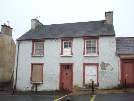
Detached three-bay two-storey house with attic level, built c. 1840, having two-bay single-storey extension attached to the north gable end, and with two-storey extension to rear (unfinished). Now disused. Pitched artificial slate roof (fibre cement) having projecting eaves course, some surviving sections of cast-iron rainwater goods, and with rendered chimneys with flat copings. Roughcast rendered rubble stone walls. Irregularly-spaced square-headed window openings with decorative raised smooth rendered surrounds, painted stone sills, and with eight-over-eight pane timber sliding sash windows to outer bays and central six-over-six pane timber sliding sash window at first floor level; ground floor openings now blocked. Square-headed doorway, offset slightly to the north side of centre, having decorative raised smooth rendered surround, battened timber door with decorative ironmongery, and with four-paned overlight. Road-fronted on sloping site to the north of the centre of Milford. Attached two-bay single-storey extension to the north having pitched natural slate roof with projecting eaves course, and with rendered chimneystack to the north gable end having decorative clay pots over, rubble stone walls (formerly roughcast rendered; rendered to the north gable end), square-headed window opening having stone sill, and raised smooth rendered surround, and timber sliding sash window (now blocked), and with square-headed doorway having raised smooth rendered surround, battened timber door, and plain overlight. Laneway to the south giving access to rear (west). Detached two-storey outbuilding to the rear (west) having pitched natural slate roof, partially roughcast rendered rubble stone walls, and square-headed openings (outbuilding not viewed clearly). Pathway to east with modern metal bollards to Main Street.
This official record and map point do not grant access. Most recorded buildings are privately owned; view them only from public ground unless the owner allows entry.