Add your own picture and explain the route, parking, gates, paths or landmarks that help people find it.
Earn 5 points after the picture is checked and accepted.
Add your photo and local directionsShare what you foundWhat is recorded here
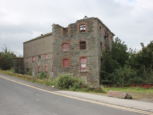
Freestanding multiple-bay four and five-storey former corn mill complex in several blocks, built c. 1868 and extended c. 1890. Later also in use to generate electricity from 1905 or 1923 until 1954. Mill remained in production until 1980s, now derelict. Detached single-storey turbine house to rear of site. Pitched roofs, some now collapsed, originally of natural slate and later of corrugated-metal. Hipped natural slate roof (purple slate) to former office block having brick eaves courses including dogtooth course. Double pitched roof with steel truss structure to block to west with smooth rendered gable copings. Squared and coursed rubble stone walls with flush quoins to the corners; roughcast render to top floor of south-east block, smooth rendered walls to south gable of west block. Segmental headed window openings with polychromatic red and yellow brick surrounds with remains of multi-pane metal and timber casement window frames. Square-headed and segmental-arch door openings, some now infilled with blockwork, having polychromatic red and yellow brick surround and ashlar lintels. Set back from road overlooking Mill River to the south end of Buncrana. Weir to west. Steps giving access to river to rear of complex. Rubble stone boundary wall to road. Interior burnt out but some metal machinery remains insitu.
This official record and map point do not grant access. Most recorded buildings are privately owned; view them only from public ground unless the owner allows entry.