Add your own picture and explain the route, parking, gates, paths or landmarks that help people find it.
Earn 5 points after the picture is checked and accepted.
Add your photo and local directionsShare what you foundWhat is recorded here
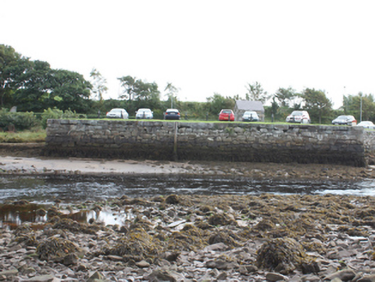
Quay and retaining wall, built c. 1850. Located on the eastern shore of the Crana River close to the point where it discharges into Lough Swilly\Buncrana Bay. Constructed of rubble stone masonry (large irregular rubble stone blocks) with slight batter to base. Roughly dressed rubble stone coping to edge with squared rubble stone quoins to the corners. Tarmacadam deck in use as car park. Some remaining cast-iron rope tie-rings to coping to edge of pier. Rubble stone retaining wall to the south. Double-arched bridge, c. 1800, to the south carrying road over small stream having roughly dressed quoins to arches and rubble stone construction. Detached single-bay single-storey structure to site, possible originally a gate lodge associated with Buncrana Castle (see 40815001) or a former winch house, having pitched natural slate roof, squared rubble stone walls, square-headed window openings (now blocked) having cut stone sills, and with square-headed doorway to the east elevation having replacement timber door. Set on the eastern side of the mouth of the Crana River, to the south-east of Buncrana Castle and to the north-west of Buncrana town centre.
This official record and map point do not grant access. Most recorded buildings are privately owned; view them only from public ground unless the owner allows entry.