Add your own picture and explain the route, parking, gates, paths or landmarks that help people find it.
Earn 5 points after the picture is checked and accepted.
Add your photo and local directionsShare what you foundWhat is recorded here
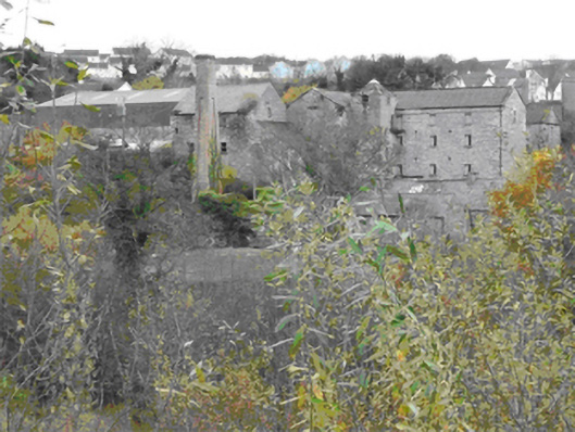
Attached multiple-bay two-, three- and four-storey former corn mill complex on irregular-plan, built c. 1811 and 1840 and extended c. 1880. Now in multiple industrial uses. Hipped and pitched slate roofs with stone eaves courses to some blocks, and with surviving sections of cast-iron rainwater goods. Replacement corrugated asbestos cement roof to some sections. Rubble stone walls. Square-headed window and door openings with roughly squared rubble stone voussoirs, some surviving stone sills, and with remains of timber fittings. Wrought-iron security bars to ground floor openings to some blocks. Detached single-storey buildings to the south having pitched natural slate roofs, rubble stone walls, and square-headed window and door openings. Red brick chimneystack (on square-plan) to the west of site, added c. 1900. Detached two-bay single-storey lodge\office to the east, built c. 1947, having flat-roof, rendered walls, square-headed window and door openings, recessed porch to the west end supported on rubble stone-clad pillar, and projecting tapering rubble stone clad chimneybreast and chimneystack to the east end. Altered two-storey former corn mill (on L-shaped plan) to the south-east, built c. 1810 and extended c. 1850. Located adjacent to the east of the Bredagh River, and to the north-west of the centre of Moville.
This official record and map point do not grant access. Most recorded buildings are privately owned; view them only from public ground unless the owner allows entry.