Add your own picture and explain the route, parking, gates, paths or landmarks that help people find it.
Earn 5 points after the picture is checked and accepted.
Add your photo and local directionsShare what you foundWhat is recorded here
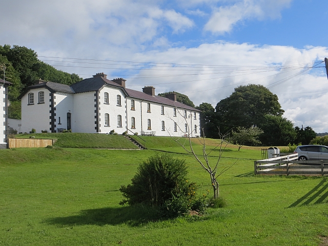
Freestanding eight-bay two-storey former coastguard station, built c. 1868-69, with projecting gabled half-hipped pair of bays to the south-west, and recessed bays to south-west and north-east; single-storey lean-to entrance porches to rear, oriel windows to the north-east and to the north-west sides, both over segmental-arched machicolations on corbels. Now in use as houses. Hipped and half-hipped slate roofs with exposed timber rafters to eaves; brick chimneystacks with stringcourses and corniced coping; cast-iron and replacement rainwater goods. Lean-to natural slate roofs to entrance porches. Painted coursed rubble walls with painted tooled ashlar block-and-start quoins, and projecting plinth. Segmental-arched window openings with painted tooled ashlar block-and-start surrounds with six-over-six horned timber sash windows. Square-headed window openings with six-over-six horned timber sash and some replacement windows to rear. Segmental-arched door openings to recessed bays with timber panelled door and overlight to north-east and half-glazed timber-framed door with overlight to south-west. Square-headed door openings to rear porches with assortment of doors. Row of detached single-storey outhouses to rear with pitched slate and corrugated metal roofs, rubble stone walls with ashlar block-and-start quoins, square-headed window openings with three-over-three horned timber sash window to central outbuilding, square-headed door openings with assortment of battened timber doors. Wrought-iron gate mounted on tooled ashlar gate-piers with tapered coping to front and to rear. Ashlar stone steps to front. Set within own grounds with later block of houses (see 40809003) to the south-west. Grassed area to front of property. Located to west of Moville town centre overlooking Lough Foyle and with Carrickarory Pier (see 40809001) to the south-west.
This official record and map point do not grant access. Most recorded buildings are privately owned; view them only from public ground unless the owner allows entry.