Add your own picture and explain the route, parking, gates, paths or landmarks that help people find it.
Earn 5 points after the picture is checked and accepted.
Add your photo and local directionsShare what you foundWhat is recorded here
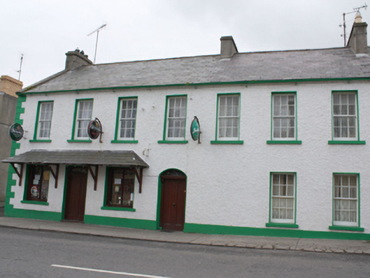
Attached end-of-terrace seven-bay two-storey house, built c. 1820. Later in use as a constabulary barracks c. 1890. Possibly a terrace of two or three houses, later combined. Now also in use as a public house (east end), with two-storey extension, single-storey shed and temporary smoking room to rear (south). Possibly formerly in use as a constabulary barracks, c. 1900. Pitched natural slate roof with clayware ridge tiles, projecting eaves course, three smooth rendered chimneystacks (one to either end and one offset to the west side of centre), and with cast-iron rainwater goods. Modern hipped slate canopy roof to public house front. Roughcast rendered walls over smooth rendered plinth course with rendered block-and-start quoins to the corner at the east end. Square-headed window openings with painted sills, smooth rendered reveals, and with six-over-six pane timber sliding sash windows; enlarged square-headed window openings to public house to the east end having fixed-pane display windows. Central segmental-headed doorway having smooth rendered reveal, plinth blocks, timber panelled door with two round-headed panels, plain overlight and with timber pilasters with moulded console brackets supporting moulded timber lintel over. Square-headed doorway to pub having timber panelled double-doors. Road-fronted to the south side of Main Street, Culdaff. Laneway to the east gable end giving access to the rear.
This official record and map point do not grant access. Most recorded buildings are privately owned; view them only from public ground unless the owner allows entry.