Add your own picture and explain the route, parking, gates, paths or landmarks that help people find it.
Earn 5 points after the picture is checked and accepted.
Add your photo and local directionsShare what you foundWhat is recorded here
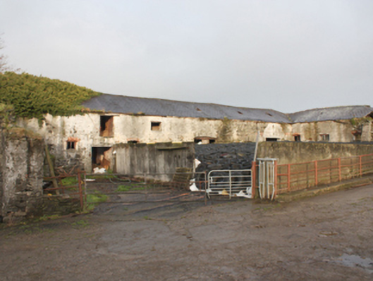
Complex of multiple-bay two-storey outbuildings (on L-shaped plan) associated with Malin Hall (see 40801015), built c. 1760 and extended c. 1840. Now partially out of use. Formerly part of a courtyard of outbuildings, east side of complex demolished post 1902 (Ordnance Survey twenty-five inch map). Pitched natural slate roofs with metal skylights, clayware ridge tiles, red brick eaves course and surviving sections of cast-iron rainwater goods. Roughcast rendered rubble stone walls. Segmental -headed window openings with red brick voussoirs, remaining stone sills, and remains of timber casement windows; some square-headed window openings at first floor level. Square-headed door openings with red brick voussoirs and remains of battened timber doors. Segmental-headed carriage-arch to the centre of main range to the west of complex. Rubble stone boundary walls and remains of rubble stone structures to site. Set within a working farmyard to the north of Malin Hall with modern farm buildings to east. Detached multiple-bay single-storey outbuilding or former stables to the south-east, adjacent to the north-east of main house, having pitched natural slate roof, partially rendered rubble stone walls, and square-headed openings. Set well back from road in extensive mature parkland grounds to the north-west of Malin, and to the north\north-west of main house.
This official record and map point do not grant access. Most recorded buildings are privately owned; view them only from public ground unless the owner allows entry.