Add your own picture and explain the route, parking, gates, paths or landmarks that help people find it.
Earn 5 points after the picture is checked and accepted.
Add your photo and local directionsShare what you foundWhat is recorded here
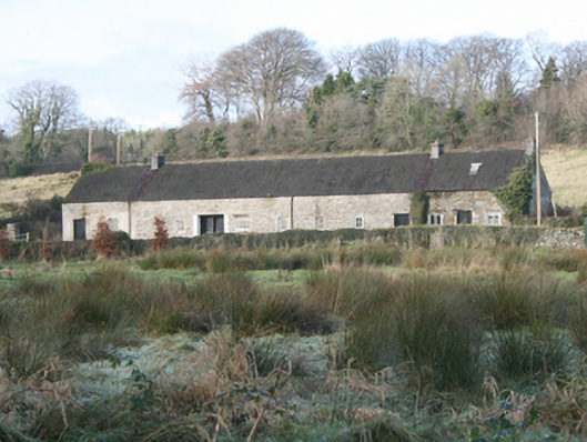
Detached twelve-bay single-storey former linen processing\weaving sheds, built c. 1780. Later associated with Salmon fishery. Now in use as outbuildings with three bays to the east end now in use as a dwelling. Pitched timber shingle roof (formerly thatched) having three smooth rendered chimneystacks (one to either side of dwelling and one towards the west end) and cast-iron rainwater goods; metal skylight to house. Partially roughcast rendered random rubble stone walls. Square-headed window openings with range of timber casement and pivoting timber windows, and with timber lintels; wrought-iron security bars to some openings. Square-headed door openings with battened timber doors, and some surviving timber lintels. Square-headed carriage-arch inserted to the west side of the centre of the main elevation (south) having concrete lintel, battened timber double-doors, and with central demountable timber post. Set back from road in own grounds to the west of the centre of Ramelton. Laneway to the front (south) bounded to the south by rubble stone wall. Gateway to the south-east leading to The Green (see 40800305_1). Former bleaching green and former watchmen’s huts and two single-storey corrugated-iron buildings adjacent to the east and south.
This official record and map point do not grant access. Most recorded buildings are privately owned; view them only from public ground unless the owner allows entry.