Add your own picture and explain the route, parking, gates, paths or landmarks that help people find it.
Earn 5 points after the picture is checked and accepted.
Add your photo and local directionsShare what you foundWhat is recorded here
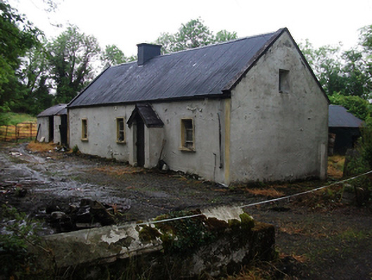
Detached four-bay single-storey vernacular dwelling on direct-entry plan, built c.1810, with gable-fronted windbreak and early twentieth-century lean-to extension to rear, now derelict. Pitched corrugated-iron roof with cement barge copings, slate roof to windbreak with timber barge boards. Rendered chimneystack and steel rainwater goods. Smooth rendered random rubble walls with raised bands to corners, line of original thatch eaves visible at gable. One-over-one timber sash windows to south elevation with quarter-round horns in raised surrounds, with squared stone sills. Historic single-pane casement windows at high level to gable eaves. Battened timber door with triangular overlight opening onto flagstone threshold. Smooth rendered random rubble extension with corrugated-iron roof and two-over-two timber sash windows. Corrugated-iron barrel-roofed extension attached to west gable. Farmyard with rendered outbuildings to rear. Rendered boundary wall to east and south with pier supporting forged gate. Set within courtyard-plan farmyard with dwelling facing south and perpendicular to road.
This official record and map point do not grant access. Most recorded buildings are privately owned; view them only from public ground unless the owner allows entry.