Add your own picture and explain the route, parking, gates, paths or landmarks that help people find it.
Earn 5 points after the picture is checked and accepted.
Add your photo and local directionsShare what you foundWhat is recorded here
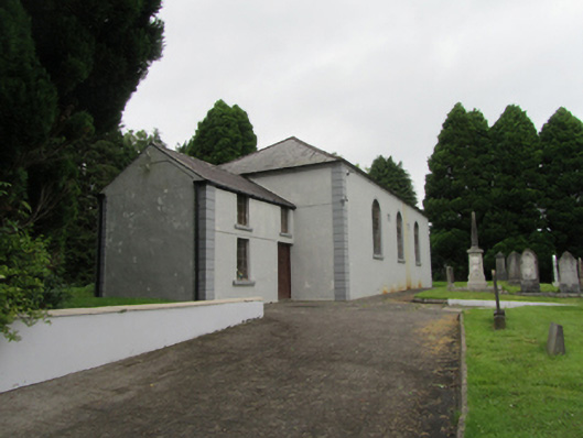
Freestanding three-bay single-cell Presbyterian church, built 1837, two-storey two-bay addition to south gable, recent boiler house to rear. Hipped slate roof with clay ridge and hip tiles, hipped roof to south attachment, cast-iron rainwater goods. Smooth ruled-and-lined rendered walls with corbel stone at eaves, channel jointed smooth quoins to corners. Recessed inscribed stone plaques between windows, south plaque ‘REV. JOHN KING / MINISTER’ and north plaque ‘BELLASIS / 1837’. Round-headed openings to nave with smooth plaster surrounds, stone sills, and replacement multiple pane timber windows. Timber sheeted entrance door. Interior with flat plaster ceiling having recessed timber vents above aisle. Concave cornice profile to plastered walls, with timber dado to lower section of north wall. Timber sheeted double doors to entrance lobby. Steps to north end with timber lectern, font, and desk. Coloured clay tiles to entrance lobby with timber stairs leading to upper level. Timber wall bench in ground floor room off lobby. Stone grave monuments in graveyard directly east of church. Rendered masonry boundary walls having octagonal-profile stone piers with profiled caps flanking forged metal gates. Recent metal gates and masonry piers to pedestrian entrance to east of church. Detached single-storey corrugated-iron building, c.1950, to south.
This official record and map point do not grant access. Most recorded buildings are privately owned; view them only from public ground unless the owner allows entry.