Add your own picture and explain the route, parking, gates, paths or landmarks that help people find it.
Earn 5 points after the picture is checked and accepted.
Add your photo and local directionsShare what you foundWhat is recorded here
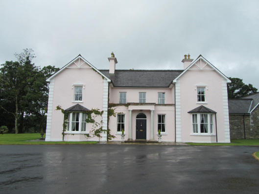
Detached five-bay two-storey house, built c.1890, with projecting two-storey gabled outer bays flanking recent single-storey entrance, south gable probably post 1910, two-storey return to south-west. Alterations comprising two-storey rear extension and timber conservatory to south c.2000, single-storey outbuildings to west, south-west and north, converted c.2005, forming rectangular yard to rear. Pitched slate roof with perforated clay ridge tile, rendered replacement chimneystacks with recent stepped profiles and historic clay pots to front and rear sections. Roof overhangs at eaves and gables with decorative timber trusses to gables, recent timber bargeboards, replacement rainwater goods. Smooth rendered walls with channel jointed smooth quoins and smooth plinth. Two-over-two timber sash windows with stone sills. Bay windows to east gables with timber uprights at corners supporting slate roof with two-over-two timber sash windows. Windows above bays with recent pediments on brackets. Recent entrance porch with precast concrete columns, round-headed door opening with fanlight and recent timber door. Recent projection to south-east gable with timber doors flanked by precast concrete columns and balcony over. Outbuildings with replacement pitched slate roofs, altered and new openings with recent brick dressing, recent limestone sills and uPVC windows. Water channels connecting former mill race with lake in west and Nadreegeel Lough to south-west.
This official record and map point do not grant access. Most recorded buildings are privately owned; view them only from public ground unless the owner allows entry.