Add your own picture and explain the route, parking, gates, paths or landmarks that help people find it.
Earn 5 points after the picture is checked and accepted.
Add your photo and local directionsShare what you foundWhat is recorded here
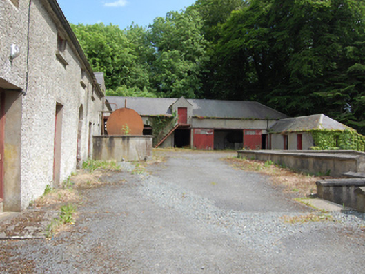
Range of L-plan multiple-bay two-storey outbuildings, built c.1740, arranged around central courtyard, having gabled half-dormers with loft doors positioned off-centre to both ranges. Three-bay single-storey outbuilding to west of eastern block. Now disused. Slate roof having hipped end to south and gable end to east, rendered chimneystack to gable, sections of cast-iron rain water goods. Roughcast rendered walls. Squared-headed door openings and square-headed window openings beneath eaves to west side of north range. Wide elliptical-arched and square-headed machinery openings to east side of north range and east range. Sheeted timber doors, half-glazed panelled door to west bay, and fixed multiple pane windows. Later external metal steps to loft openings. Bounded by low rendered walls having square-profile gate piers with pyramidal capstones.
This official record and map point do not grant access. Most recorded buildings are privately owned; view them only from public ground unless the owner allows entry.