Add your own picture and explain the route, parking, gates, paths or landmarks that help people find it.
Earn 5 points after the picture is checked and accepted.
Add your photo and local directionsShare what you foundWhat is recorded here
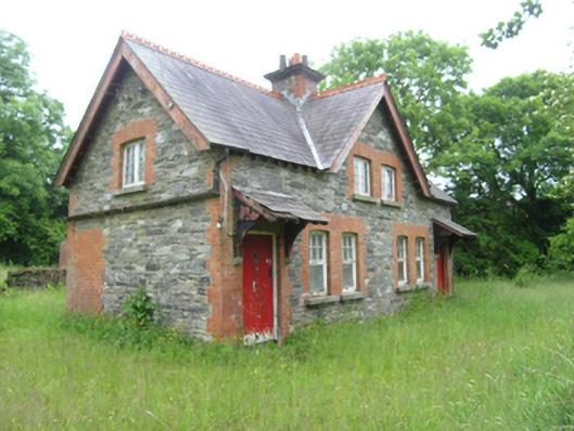
Pair of Victorian semi-detached three-bay two-storey houses, built c.1890, sharing common central gable with entrances in the outer bays, and recent single-storey extension to rear. Currently disused. Pitched slate roof with plain bargeboards, crested clay ridge tiles, central brick chimneystack with decorative brick cornice, and exposed rafters at eaves, and bargeboards at gables, with remains of cast-iron rainwater goods. Lean-to slate roof above porches resting on timber brackets on stone corbels. Random rubble stone walls with brick dressings to openings and quoins. Paired windows openings on front elevation, single windows in gables, and smaller windows on rear elevation, all with stone sills. Timber casement windows with eight-pane lights to upper floor and six-over-one to ground floor. Timber sheeted doors to front and rear elevations. Shared outbuilding to east with pitched slate roof, and rubble-stone walls with brick dressing to openings and corners. Remains of rubble stone walls to rear.
This official record and map point do not grant access. Most recorded buildings are privately owned; view them only from public ground unless the owner allows entry.