Add your own picture and explain the route, parking, gates, paths or landmarks that help people find it.
Earn 5 points after the picture is checked and accepted.
Add your photo and local directionsShare what you foundWhat is recorded here
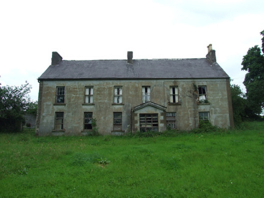
Detached six-bay two-storey house, built c.1780, with gable-fronted porch to front added c.1880. Irregular fenestration to rear with lean-to porch. Now disused. Pitched slate roof with clay ridge tiles, rendered chimneystacks to gables and to centre of ridge, south stack having decorative clay pots. Cast-iron rainwater goods with hopper head to north gable, decorative timber bargeboards to porch. Smooth ruled-and-lined rendered walls to front, roughcast rendered walls to rear. Cut stone block and start quoins to front porch. Square-headed window openings with droved sandstone sills, having six-over-six sliding sash windows with convex horns to rear and north gable windows, one six-over-six surviving to front elevation, otherwise one-over-one and later replacements with one eight-over-eight window at ground level, one eight-over-eight also to rear. Gable fronted porch off-centre to front with recent multi-paned window, door opening to side facing north with recent timber door. Retaining internal timber panelled shutters. Stone-flagged kitchen to north of central chimney and porch with wide elliptical arched hearth recess having stone voussoirs. Farm yard and outbuildings to rear. Plain wrought-iron gates and railings on sandstone plinths with cast-iron piers having rope-moulding and ball finials to road side.
This official record and map point do not grant access. Most recorded buildings are privately owned; view them only from public ground unless the owner allows entry.