Add your own picture and explain the route, parking, gates, paths or landmarks that help people find it.
Earn 5 points after the picture is checked and accepted.
Add your photo and local directionsShare what you foundWhat is recorded here
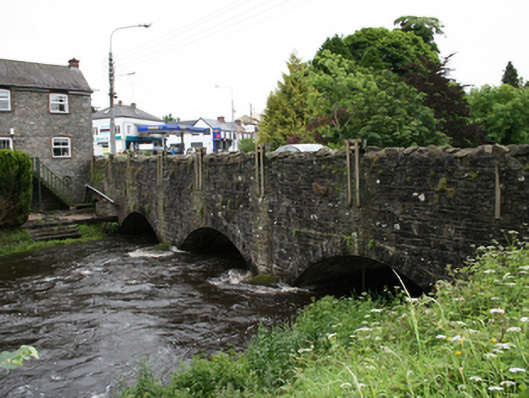
Triple-arch stone road bridge, dated 1894, spanning river flowing from north into Lough Ramor. Additional blocked-up arch to east end over mill race of adjacent former mill. Widened at east end c.1980. Rock-faced voussoirs to segmental arches with rendered arch soffits. Pair of U-cutwaters to south piers rising above apex of arches. Spandrels and wing walls of coursed random rubble stone, upper sections re-laid and re-pointed, parapet rebuilt with Scotch coping. Plaque on south face of north parapet wall reads ‘P. Lee B.L.D.R 1894’. Remains of pedestrian entrance in rendered wall at west end of south parapet with block-and-start ashlar sections. Recent service pipe of metal resting on cutwaters to south side.
This official record and map point do not grant access. Most recorded buildings are privately owned; view them only from public ground unless the owner allows entry.