Add your own picture and explain the route, parking, gates, paths or landmarks that help people find it.
Earn 5 points after the picture is checked and accepted.
Add your photo and local directionsShare what you foundWhat is recorded here
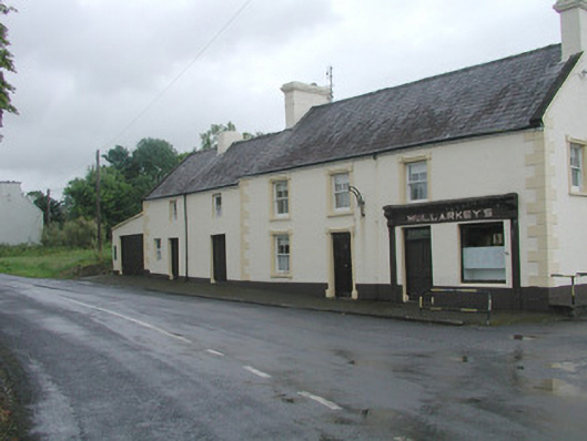
Detached three-bay two-storey rendered house, built c. 1870. Pubfront c. 1910 to west side of north elevation of main building, slightly lower three-bay secondary building to east, lean-to garage to east gable-end. Pitched slate roofs, clay ridge tiles, concrete verge cappings to east and west gables, painted smooth-rendered corbelled chimneystacks, half-round cast-iron gutters on moulded eaves courses, cast-iron downpipe. Painted smooth-rendered ruled-and-lined walling, raised render channel-jointed quoins, painted plinth. Square-headed window openings, painted moulded architraves with square corner blocks at heads to main building, painted stone sills, painted two-over-two timber sash windows. Pubfront with square painted timber display window, square-headed door opening, painted timber double doors each with two stop-chamfered panels, plain-glazed overlight with applied licensing details, sign-written plain fascia and moulded cornice terminating in profiled consoles on fluted pilasters. Square-headed door openings, painted moulded architraves with square corner blocks at head to main entrance door, painted panelled timber door with narrow sidelight and overlight c. 1980, painted vertically-sheeted timber double doors to secondary building. Stone outbuilding to rear with pitched slate roof, accessed through corrugated-iron gate. Road facing, set to back of pavement, corner-sited at T-junction.
This official record and map point do not grant access. Most recorded buildings are privately owned; view them only from public ground unless the owner allows entry.