Add your own picture and explain the route, parking, gates, paths or landmarks that help people find it.
Earn 5 points after the picture is checked and accepted.
Add your photo and local directionsShare what you foundWhat is recorded here
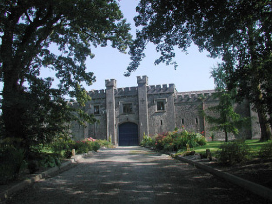
Detached stone stable yard, built c. 1830. Square plan, castellated entrance front (west) with crenellated corbelled parapet, central three-bay breakfront with battered sides and square-profile buttresses terminating in crenellated turrets. Square-profile crenellated corner towers. Partially converted to private dwelling with two-storey house added to north c. 1990. Hipped slate roof, dressed stone chimneystack to north-east, cast-iron rainwater goods. Rubble limestone walling with tooled limestone ashlar quoins, parapets and buttresses, limestone corbels to parapet. Square headed window openings, limestone hood moulds to first floor windows, chamfered reveals, limestone sills, timber casements c. 1990. Square-headed slit windows with limestone ashlar surrounds, chamfered reveals to ground floor. Pointed-arch window openings to south elevation, remains of original six-over-six timber sash windows. Pointed-arch door opening to centre of west breakfront, ashlar surround, chamfered reveals, limestone flagstones, painted timber double doors each with twelve panels. Set back from laneway with landscaped parkland to west and north, farmland to east and south, rubble stone boundary wall with rusticated limestone gate piers to west.
This official record and map point do not grant access. Most recorded buildings are privately owned; view them only from public ground unless the owner allows entry.