Add your own picture and explain the route, parking, gates, paths or landmarks that help people find it.
Earn 5 points after the picture is checked and accepted.
Add your photo and local directionsShare what you foundWhat is recorded here
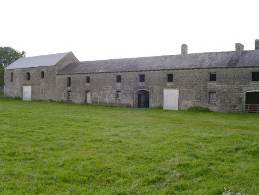
Detached eleven-bay two-storey rubble stone former corn mill, built c. 1800, now in use as agricultural store. Rectangular linear plan, eight-bay east range, higher three-bay west range. Hipped slate roof to east range, brick corbelled chimneystack, clay ridge tiles, timber eaves beam carried on horizontal timber roof ties projecting as corbels. Pitched corrugated-iron roof to west range, concrete verges, eaves corbel course. Uncoursed rubble limestone walling. Square-headed window openings, ashlar dressings, stone sills, some timber sash window cases and one six-paned sash survive. Segmental headed door and carriage openings, ashlar limestone twice-rebated surrounds. Segmental headed window openings to west range, some infilled, windows missing. Rectangular grass-covered courtyard to south, rubble stone boundary walls, approached by lane from south, O'Dowd's Castle to north.
This official record and map point do not grant access. Most recorded buildings are privately owned; view them only from public ground unless the owner allows entry.