Add your own picture and explain the route, parking, gates, paths or landmarks that help people find it.
Earn 5 points after the picture is checked and accepted.
Add your photo and local directionsShare what you foundWhat is recorded here
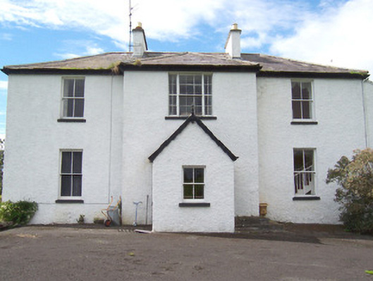
Detached three-bay two-storey over basement rendered former rectory, built c. 1810, in use as farmhouse since 1930. Rectangular plan, basement exposed as ground floor to west elevation, single-bay breakfront to east elevation with projecting single-storey gabled porch, three-storey central bow to west, lean-to three-storey wing to north to full width of main house, single-storey linear outbuilding to north offset to west. Hipped slate roofs to main house with conical roof over bow, pitched slate roofs to porch and outbuilding, clay ridge and hip tiles, half-round cast-iron gutters on eaves corbel course, moulded gutters to porch and outbuilding. Painted roughcast walling. Square-headed window openings, smooth-rendered reveals, painted stone sills, painted two-over-two timber sash windows, tripartite six-over-six flanked by four-over-four above porch, six-over-six to three ground floor windows to bow, painted timber casement windows to basement and outbuilding. Square-headed entrance door opening to north side of porch, painted timber six-panel door. Gravelled forecourt with grass central space. Narrow courtyard to east of outbuilding, high rubble stone wall further to east. Located on axis with church to east, approached by long driveway, gate lodge with hipped roof at entrance, wrought-iron gates.
This official record and map point do not grant access. Most recorded buildings are privately owned; view them only from public ground unless the owner allows entry.