Add your own picture and explain the route, parking, gates, paths or landmarks that help people find it.
Earn 5 points after the picture is checked and accepted.
Add your photo and local directionsShare what you foundWhat is recorded here
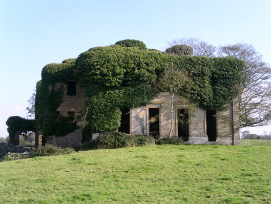
Detached multi-bay two-storey rendered house, built c. 1842, now ruinous. Symmetrical main elevations, extensive vegetation growth internally and externally. Roof collapsed, remains of chimneystacks survive, section of moulded eaves cornice survives. Painted smooth-rendered walling, horizontal banding between floors, plain pilasters to corners, moulded dado, ashlar limestone plinth. Square-headed full-height window openings, moulded architraves, entablatures supported on console brackets, all evidence of timber windows missing. No evidence of entrance doors survive. All internal finishes and features removed. Remote location in fields.
This official record and map point do not grant access. Most recorded buildings are privately owned; view them only from public ground unless the owner allows entry.