Add your own picture and explain the route, parking, gates, paths or landmarks that help people find it.
Earn 5 points after the picture is checked and accepted.
Add your photo and local directionsShare what you foundWhat is recorded here
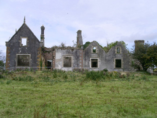
Detached multiple-bay single-storey with attic over basement rendered house, built c. 1870, now in ruins. Cruciform plan, entrance porch in south-east corner (now missing), two contiguous north-south wings to east. Steeply-pitched roofs missing, remnants of ashlar stone diagonally-set chimneystacks with stepped capping, ashlar stone chamfered verge copings on corbelled springers with pointed finials. Roughcast walling, smooth-rendered block-and-start quoins, chamfered ashlar basement string course. Square-headed window openings, moulded render surrounds, hood mouldings, stone sills, windows missing. Two segmental-headed arches to basement to north elevation of east wings, tooled ashlar stone jambs and voussoirs. Square-plan farmyard to north, bounded by two-storey farm buildings, pitched slate roofs, painted smooth-rendered stepped and corbelled chimneystacks to south gables, squared rubble stone walling, tooled ashlar stone quoins. Further yard to north, high unpainted roughcast boundary walls, tall ashlar stone campanile to north-west corner, segmental-headed belfry openings on corbelled cornice, pyramidal ashlar stone roof. Set in rural landscape.
This official record and map point do not grant access. Most recorded buildings are privately owned; view them only from public ground unless the owner allows entry.