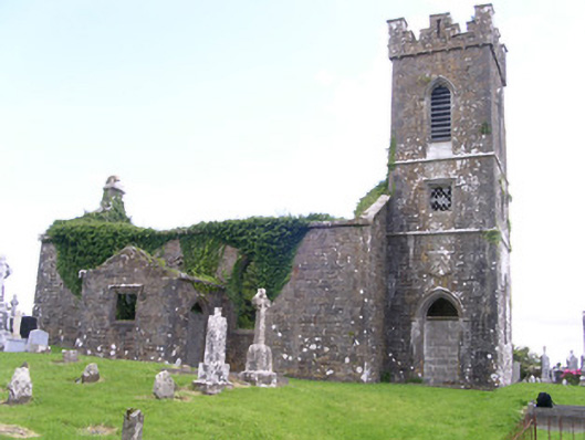
Add your own picture and explain the route, parking, gates, paths or landmarks that help people find it.
Earn 5 points after the picture is checked and accepted.
Add your photo and local directionsShare what you foundWhat is recorded here
Detached single-cell limestone former church built c. 1830, now ruinous. East-west three-bay nave, three-stage square tower to west, vestry to centre of north elevation of nave. Roofs missing, ashlar verge copings, ashlar corbelled chimneystack to east gable. Coursed squared-rubble walling, unpainted smooth-rendered north elevation tooled ashlar quoins, ashlar eaves corbel course to nave, stepped castellated parapet to tower on corbelled string with ashlar copings, moulded strings between stages to tower, shield plaque above north-facing entrance door at base of tower. Pointed-arch window openings to nave, lancet window ground floor tower, square-headed window openings to second stage tower and vestry, tooled splayed ashlar surrounds, flush sills, hood mouldings to lancet and square windows, glazing missing except diamond-pattern cast-iron fixed lights to second stage tower. Pointed-arch belfry openings to third stage tower, tooled splayed ashlar surrounds, flush sills, hood mouldings, painted timber louvres. Pointed-arch door openings to tower and vestry, tooled splayed ashlar surrounds, hood mouldings,openings built-up. Graveyard surrounding church with wide variety of grave markers, rubble boundary walls, metal gates to north-east, gravel drive leads downhill to main road to north.
This official record and map point do not grant access. Most recorded buildings are privately owned; view them only from public ground unless the owner allows entry.