Add your own picture and explain the route, parking, gates, paths or landmarks that help people find it.
Earn 5 points after the picture is checked and accepted.
Add your photo and local directionsShare what you foundWhat is recorded here
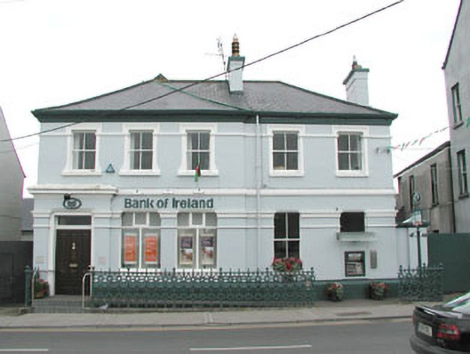
Detached five-bay two-storey rendered bank, built c. 1910. L-plan, three-bay breakfront to east side with forward-projecting porch doorcase to extreme east. Hipped slate roof, clay ridge and hip tiles, painted smooth-rendered chimneystacks, moulded cast-iron gutters embellished with lion's head motifs on moulded render eaves corbel course. Painted smooth-rendered walling, moulded string courses at first floor and window head levels, moulded plinth. Square-headed window openings, painted concrete sills, decorative moulded heads and plain bands to reveals (kneed to breakfront) to first floor, painted two-over-two timber sash windows except two painted timber casement windows to banking hall, ground floor window to west modified to accept cash dispenser. Painted smooth-rendered plain frieze over ground floor windows and door with individually-lettered sign. Square-headed entrance door opening in painted smooth-render, doorcase with flanking pilasters with moulded caps, plain frieze containing bank logo, moulded cornice, plain-glazed overlight, hardwood door with six raised-and-fielded panels c. 1970. Two steps from footpath, small paved area to front bounded by ornate cast-iron railings, painted smooth-rendered gate piers with pyramidal copings to west, painted sheet-metal gates c. 1995, alleyways to east and west sides, taller three-storey building to west, lower two-storey building to east.
This official record and map point do not grant access. Most recorded buildings are privately owned; view them only from public ground unless the owner allows entry.