Add your own picture and explain the route, parking, gates, paths or landmarks that help people find it.
Earn 5 points after the picture is checked and accepted.
Add your photo and local directionsShare what you foundWhat is recorded here
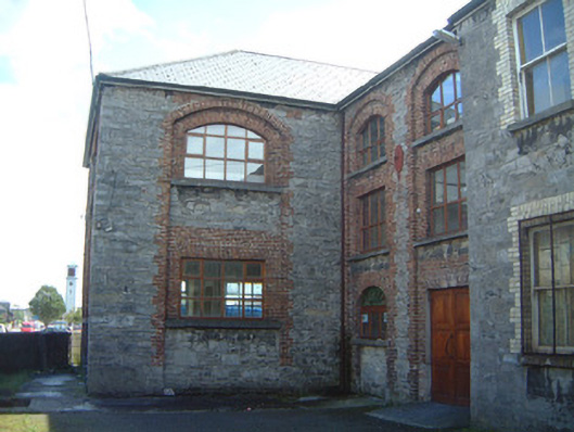
Attached corner-sited multi-bay two- and three-storey stone school building, built c. 1830, now in use as community centre. 'L'-plan. Five-bay east elevation, two-bay north elevation to main block. Two-bay three-storey link building to west of main block adjoining building to west. Two-bay two-storey extension to south of main block c. 2000. Hipped artificial slate roofs, clay ridge tiles, moulded cast-iron gutters on painted timber fascia on eaves corbel course. Random rubble limestone walling, full-height blind arcading forming segmental-headed recessed panels to all elevations, limestone plaque located on pier between first floor windows contains National School inscription. Square-headed window openings to ground floor, segmental-headed to first floor, block-and-start red brick surrounds, limestone sills, multi-pane hardwood casements c. 2000. Former elliptical-headed door opening to ground floor north elevation link building, now window but retaining sunburst fanlight. Square-headed door opening to ground floor north elevation link building, red brick surround, hardwood double doors each with three panels c. 2000. Corner sited, set back from road on restricted site, smooth-rendered high masonry boundary wall to north, lower roughcast wall to splayed north-east corner and east boundary, entrance from Chapel Street.
This official record and map point do not grant access. Most recorded buildings are privately owned; view them only from public ground unless the owner allows entry.