Add your own picture and explain the route, parking, gates, paths or landmarks that help people find it.
Earn 5 points after the picture is checked and accepted.
Add your photo and local directionsShare what you foundWhat is recorded here
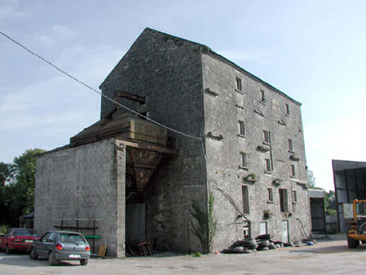
Detached four-bay five-storey former corn mill, built c.1860, abutted by ruinous mid-twentieth-century structures including grain store. Now derelict. Pitched corrugated-asbestos roof. Random coursed stone to front and side elevations with tooled quoins, tooled eaves course and voussoirs to openings. Concrete ties projecting from façade. Brick cambered-arched and cut stone flat-arched window and door openings, now blocked up. Rear elevation rebuilt with concrete blocks after fire c.1965. Ancillary stone buildings to south have been remodelled. Possible remains of weir to river. Site is now used as a grain depot.
This official record and map point do not grant access. Most recorded buildings are privately owned; view them only from public ground unless the owner allows entry.