Add your own picture and explain the route, parking, gates, paths or landmarks that help people find it.
Earn 5 points after the picture is checked and accepted.
Add your photo and local directionsShare what you foundWhat is recorded here
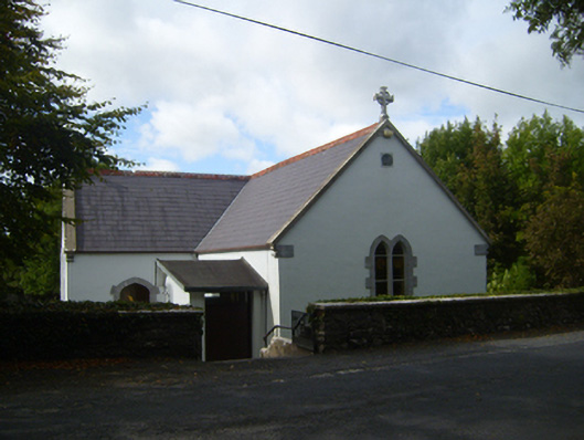
Freestanding cruciform-plan Roman Catholic church, dated 1842, having two-bay nave, single-bay transepts, shallow single-bay chancel (to west end), recent sacristy to west gable, and recent gabled porch to south elevation. Pitched slate roofs having terracotta ridge cresting, cast-iron rainwater goods, limestone copings and sculpted limestone Celtic cross finials. Lined-and-ruled render to walls, with plinth course. Inscribed limestone plaque to external wall of south transept. Pointed arch window openings, double-light to transept gables and to east end of nave, with tooled limestone sills and block-and-start surrounds to all elevations except for those to rear of building, latter being rendered, and nave windows having stained glass. Row of three square-headed timber windows to north elevation of sacristy. Tudor-arch doorway in east wall of south transept, having tooled block-and-start surround, converted to window. Square-headed double-leaf timber battened doors to east and west sides of porch, with overlights. Square-headed timber battened door with overlight to south elevation of sacristy. Square-plan freestanding belfry to south of church, with pebbledashed and smooth rendered walls, and render cross to top, and with square-headed timber battened door to. Interior has plastered ceiling to A-frmaed roof, pointed arch to altar area, marble Stations of the Cross, and decoratively carved limestone stoup. Religious statues to nave. Carved wooden altar, reredos and tabernacle. Stained-glass windows refer to various dioceses. Rubble stone boundary wall to east of church. Two pairs of square-profile rendered piers with render capping, flanking double-leaf metal gates, one to south-east and one to north-east of building. Rubble stone boundary wall. Rendered steps with render retaining walls leading from site boundary to church.
This official record and map point do not grant access. Most recorded buildings are privately owned; view them only from public ground unless the owner allows entry.