Add your own picture and explain the route, parking, gates, paths or landmarks that help people find it.
Earn 5 points after the picture is checked and accepted.
Add your photo and local directionsShare what you foundWhat is recorded here
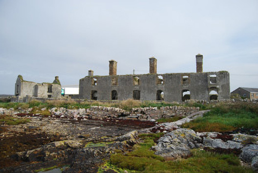
Detached six-bay two-storey former coastguard station, built c.1875, now ruinous, with three lean-to sections along rear (north-east elevation), concrete water tanks to east elevation, single-storey lean-to outhouses (animal sheds) to rear, single-storey store to north and two-storey store (formerly house associated with original station c.1830) with cart entrance to north-west. Pitched (but possibly hipped) slate roof with smooth rendered brick chimneystacks. Smooth rendered walls and plinth over rubble stone, iron vents below ground floor window openings and concrete moulded gun loops to each end of lean-to porch. Square and camber-headed openings to windows with concrete sills, yellow brick surrounds and brick arches. Two bartizan-type additions to first floor openings situated on east end of south-west elevation and north-west gable end, comprising rendered concrete with camber-headed openings having gun loops to side elevations and iron hinges to interior. Building located to east of quay on shoreline and contained within rubble stone enclosure with rendered piers to entrance. Single and two-storey outbuildings of rubble stone construction with pitched roofs, having brick surrounds to openings, single-storey outbuilding having pitched artificial slate roof and two-storey one having brick chimneystack.
This official record and map point do not grant access. Most recorded buildings are privately owned; view them only from public ground unless the owner allows entry.