Add your own picture and explain the route, parking, gates, paths or landmarks that help people find it.
Earn 5 points after the picture is checked and accepted.
Add your photo and local directionsShare what you foundWhat is recorded here
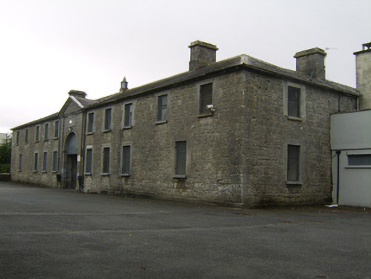
Closed U-plan two-storey former stableyard, built c.1820, of limestone and comprising eleven-bay range to east, lacking some openings to ground floor, and having integral carriage arch to middle of façade. Nine-bay ranges to north and south, and boundary wall to west. Now in use as classrooms. Pitched slate roofs to north and south ranges, hipped to east ends, hipped slate roof to east range, with cut-stone chimneystacks and eaves course and cast-iron rainwater goods with stone troughs. Snecked dressed stone walls with cut-stone plinth course. Square-headed window openings with tooled stone block-and-start surrounds and cut-stone sills with replacement timber windows. Square-headed door openings with tooled stone block-and-start surrounds with timber battened doors. Openings to west elevation of east range set in segmental-headed cut-stone arcade flush with walls with proud keystones. Round vehicular arch with carved stone surround to both elevations of east range, having carved stone pediment and Giant Order pilasters, and with raised rectangular stone panel beneath pediment. Vehicular carriage opening to west side of yard, with double-leaf cast-iron gate flanked by round-arch pedestrian entrances with cast-iron gates, cut-stone archivolts with keystones and imposts, flanked by square-profile rusticated stone piers with flat caps. Rubble stone boundary walls with cut-stone copings. Located to east of country house.
This official record and map point do not grant access. Most recorded buildings are privately owned; view them only from public ground unless the owner allows entry.