Add your own picture and explain the route, parking, gates, paths or landmarks that help people find it.
Earn 5 points after the picture is checked and accepted.
Add your photo and local directionsShare what you foundWhat is recorded here
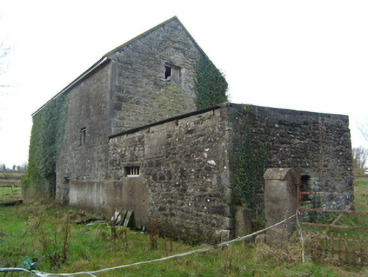
Detached four-bay three-storey former mill, built c.1800, with attic floor. Now derelict. Two-storey pitched roof extension to rear and single-storey flat corrugated-iron roofed random rubble walled extension to north. Pitched slate roof with stone copings to gables, both early twenty-first century replacements, and walling of gables showing evidence for lower pitched roof. Random rubble walls with dressed quoins. Square-headed openings with cut-stone lintels. Round-headed opening to east with draughted and pecked voussoirs, decorative round inner edge, and moulded lintel to doorway proper. Mill stream to south with remains of mill wheel to gable. Set in field with mill stream to south.
This official record and map point do not grant access. Most recorded buildings are privately owned; view them only from public ground unless the owner allows entry.