Add your own picture and explain the route, parking, gates, paths or landmarks that help people find it.
Earn 5 points after the picture is checked and accepted.
Add your photo and local directionsShare what you foundWhat is recorded here
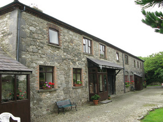
Freestanding E-plan farmyard complex, built c.1860, now converted into private and commercial accommodation. Comprises three single-storey blocks oriented north-west south-east and attached at right angles to two-storey former barn. Middle nine-bay and south twelve-bay ranges were stables and ten-bay north range was cattle byre. Steward's house to north-east. Hipped slate roofs to outbuildings with red-brick dog-tooth eaves course and some rendered chimneystacks. Exposed coursed rubble limestone walls with tooled limestone quoins. Camber-arched openings having rubbed red-brick voussoirs and surrounds, tooled limestone sills, replacement timber windows. Camber-arched carriage entrances to barn having tooled limestone voussoirs, block-and-start surrounds and tooled limestone piers, converted to window openings with concrete sills and timber windows. King-post timber trussed roof to middle range and queen-post to northern. Rubble stone enclosing walls with tooled limestone piers and galvanised metal gates enclosing area between stable blocks. Circular mill pond to north-west of farmyard which powered a turbine for the farm. Millstones to complex. Detached T-plan two-bay two-storey former steward's house, built c.1860, and having projecting chimneystack to rear, recent single-storey extension to north-east and lean-to porch to north-west. Now in use as holiday house. Pitched replacement slate roofs with carved timber finials to gables, rendered chimneystacks, timber bargeboards and replacement uPVC rainwater goods. Roughly coursed rubble limestone walls with tooled quoins and plinth with vents. Square-headed window openings with rendered (brick) surrounds, tooled stone sills and replacement uPVC windows. Square-headed door opening within porch to north-west elevation with timber panelled door. Rubble stone boundary walls and piers with wrought-iron gates, stone steps and bridge over stream to south-east elevation and timber gate to north-west with tooled stone quoins and capping to pier.
This official record and map point do not grant access. Most recorded buildings are privately owned; view them only from public ground unless the owner allows entry.