Add your own picture and explain the route, parking, gates, paths or landmarks that help people find it.
Earn 5 points after the picture is checked and accepted.
Add your photo and local directionsShare what you foundWhat is recorded here
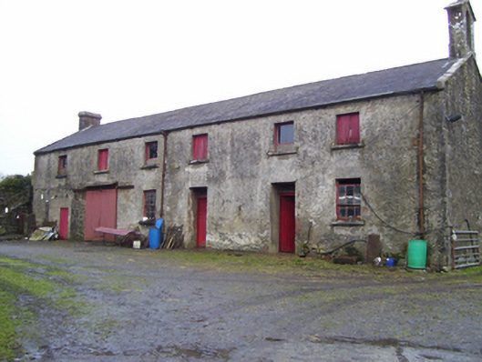
Complex of outbuildings, built c.1840, associated with now-demolished Blindwell House, comprising three yards and four ranges of buildings in row. Yard at west end built within ruins of medieval castle or fortified house. First two ranges have slated roofs and rendered walls, brick chimneystack in centre of first range and bellcote at south end of second range. Third and fourth ranges built of large blocks of squared limestone though one half of third range consists of four-bay two-storey house which is now derelict and has slated roof partly collapsed, walls with roughcast lime render, two-over-two pane timber sliding sash windows and tooled limestone sills. Beside house are two integral carriage arches, one blocked up with concrete. Fourth range has two integral carriage arches and slated roof in good repair. Entrance to yard at west end has simple limestone piers and arched pedestrian gate. Entrance to middle yard has square-plan gate piers with pyramidal capstones and cast-iron gates. Entrance to east yard has stone carriage arch and pedestrian arch with wrought-iron gates.
This official record and map point do not grant access. Most recorded buildings are privately owned; view them only from public ground unless the owner allows entry.