Add your own picture and explain the route, parking, gates, paths or landmarks that help people find it.
Earn 5 points after the picture is checked and accepted.
Add your photo and local directionsShare what you foundWhat is recorded here
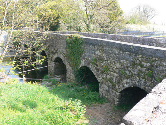
Six-arch limestone road bridge over Craughwell River, built c.1600 and widened to west perhaps late seventeenth century and to east c.1780. Original bridge was ten feet wide, early widening added two feet and later widening added same width again as original bridge. Formerly in use as vehicular bridge, now bypassed and in use as pedestrian bridge. Well preserved wicker centring to soffits of earliest part, and partly hidden arch ring towards west side of bridge, is of irregular voussoirs. Rubble stone walls, piers and parapet walls. Piers apparently refaced in squared limestone blocks, perhaps at time of latest work. Segmental arches to east elevation with cut-stone voussoirs and dressed stone V-cutwaters. Pointed round and segmental to west elevation.
This official record and map point do not grant access. Most recorded buildings are privately owned; view them only from public ground unless the owner allows entry.