Add your own picture and explain the route, parking, gates, paths or landmarks that help people find it.
Earn 5 points after the picture is checked and accepted.
Add your photo and local directionsShare what you foundWhat is recorded here
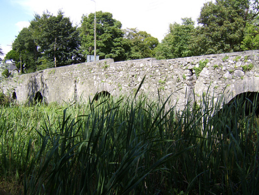
Four-arch limestone road bridge over one largely dry branch of River Suck, built c.1745, incorporating earlier fabric from bridge of c.1575. Further arch at slight distance to west. North half of depth of bridge is from the later period. Rubble walls to elevations and cut stone to soffits of later half of structure. Soffits of later part are slightly higher. Voussoirs of original north elevation are less dressed than either of current elevations. Dressed voussoirs of varying quality. Arches to south elevation slightly pointed segmental to round and those to north are elliptical, except for westmost which is more like arches of south elevation. Rubble stone parapet walls with cut-stone copings, curving to south parapet wall. Heavy cut-stone V-cutwaters to north elevation. Island in middle of river on south side of bridge forming park, with wrought-iron pedestrian gate set in parapet wall.
This official record and map point do not grant access. Most recorded buildings are privately owned; view them only from public ground unless the owner allows entry.