Add your own picture and explain the route, parking, gates, paths or landmarks that help people find it.
Earn 5 points after the picture is checked and accepted.
Add your photo and local directionsShare what you foundWhat is recorded here
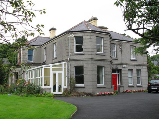
Detached irregular-plan three-bay two-storey former rectory, built c.1890, having canted-plan projection to south end of front elevation, paired windows to north end bay, and four-bay south elevation having western two bays projecting with flat-roof canted-bay window to front, next bay having flat-roof bay to front, and eastmost bay having lean-to conservatory to its front having replacement glazing and rainwater goods. Now in use as private house. Recent single-storey flat-roof extension to rear. Hipped slate roof, and yellow-brick chimneystacks having render cornices. Cut limestone eaves course, with cast-iron rainwater goods. Rendered walls, channelled to ground floor of front and south facades and to all of front canted bay. Moulded render string course between floors of same facades and continuing as cornices to projecting parts of south elevation, with rendered quoins. Square-headed window openings throughout, having tooled limestone sills and one-over-one pane timber sliding sash windows. Recessed square-headed door opening to front with timber panelled door with brass furniture and overlight and flanked by side-lights with tooled limestone sills. Square-headed door opening to north elevation having replacement timber battened door. Garden to front of house, bounded by rendered wall. Rendered rubble stone outbuildings to north-west.
This official record and map point do not grant access. Most recorded buildings are privately owned; view them only from public ground unless the owner allows entry.