Add your own picture and explain the route, parking, gates, paths or landmarks that help people find it.
Earn 5 points after the picture is checked and accepted.
Add your photo and local directionsShare what you foundWhat is recorded here
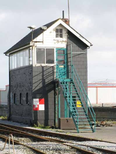
Group of three detached railway structures, built c.1860-1920, sited to south-east of Ceannt Station. Two-storey signal cabin with attic, built c.1920, having pitched artificial slate roof with red-brick chimneystack and aluminium rainwater goods, artificial slate cladding to all sides except for brick north-east wall with chamfered brick plinth. Segmental-headed window openings to ground floor of north-east side having replacement fixed timber windows with brick voussoirs and rendered sills. First floor has ribbon glazing to all sides except south-west, with square-headed lights having replacement aluminium frames. Four-pane timber casement windows to attic. Square-headed door openings to north-west gable having battened timber door to ground floor and timber glazed door to first floor, latter accessed by metal staircase. Freestanding single-stage water tower to north-west of signal cabin, built c.1850, having rusticated limestone walls with plinth, clasping pilasters to corners with margined quoinstones and supporting stepped-profile rusticated cornice with margins and surmounted by iron water tank having embossed inscriptions to west side of tank 'Courtney & Stephens Engineers Dublin 1851'. Blocked square-headed window opening to east elevation having rock-faced ashlar limestone surround. Round-headed recesses to west and south elevations with margined rusticated limestone voussoirs and surrounds, western having recent timber fittings and southern being blocked with rubble limestone. Circular turntable to north-west of water tower, built c.1920, with iron girder rotating table with timber boarding, iron tracks and metal handrails, set into circular hollow with dressed limestone coping stones to brick retaining wall, surrounded by recent timber fence.
This official record and map point do not grant access. Most recorded buildings are privately owned; view them only from public ground unless the owner allows entry.