Add your own picture and explain the route, parking, gates, paths or landmarks that help people find it.
Earn 5 points after the picture is checked and accepted.
Add your photo and local directionsShare what you foundWhat is recorded here
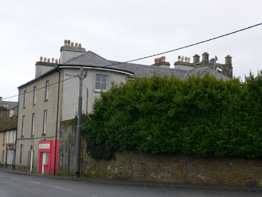
Corner-sited end of row three-storey house, built c.1780, having four-bay west elevation with bowed end bays and projecting flat-roofed three-bay cut limestone flat-roofed porch between bows, and three-bay north elevation. Slate roof, pitched to east and having rounded hips to bowed bays, and having rendered eaves course to eastern two bays of north elevation, with cast-iron rainwater goods and rendered chimneystacks. Lined-and-ruled rendered walls to north and east elevations and recent roughcast to west elevation, having rendered plinth. Square-headed two-over-two pane timber sliding sash windows throughout, with limestone sills. Round-headed doorway to north elevation having timber panelled door, fanlight and replacement one-over-one pane timber sliding sash sidelights with limestone sills. Twentieth-century render shopfront to western bay of northern elevation. Rubble limestone boundary wall to garden at north-west.
This official record and map point do not grant access. Most recorded buildings are privately owned; view them only from public ground unless the owner allows entry.