Add your own picture and explain the route, parking, gates, paths or landmarks that help people find it.
Earn 5 points after the picture is checked and accepted.
Add your photo and local directionsShare what you foundWhat is recorded here
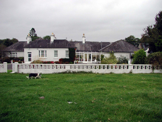
Detached nine-bay single-storey over basement farmhouse, c.1790, on an irregular plan retaining some original fenestration with four-bay single-storey projecting block to left, single-bay single-storey projecting end bay to right, and nine-bay two-storey rear (east) elevation having single-bay two-storey higher tower to north-east on a square plan. Renovated and part refenestrated, c.1990, with single-bay single-storey lean-to infill conservatory added to front (west) elevation. Hipped and pitched slate roofs (pyramidal to tower) with clay ridge tiles, rendered chimney stacks, and cast-iron rainwater goods on rendered eaves having sections of replacement uPVC rainwater goods, c.1990. Lean-to glazed roof to conservatory in uPVC frame. Painted roughcast walls. Square-headed window openings (some in bipartite arrangement with some in tripartite arrangement) with cut-stone and rendered sills. 1/1, 2/2, and 3/3 timber sash windows with some having margins, one 16/16 horizontal sliding sash window, and some replacement uPVC casement windows, c.1990, throughout. Square-headed door opening with replacement glazed uPVC door, c.1990, and overlight. Square-headed openings to infill conservatory with glazed uPVC double doors, and fixed-pane sidelights. Set back from road in own grounds with landscaped grounds to site.(ii) Detached fifteen-bay single- and two-storey rubble stone outbuilding, c.1790, on a U-shaped plan to site comprising eight-bay two-storey main block with four-bay two-storey perpendicular range to right, and three-bay single-storey perpendicular range to left. Part reroofed, c.1965. Pitched slate roofs with sections of replacement corrugated-iron, c.1965, clay ridge tiles, rendered coping, and cast-iron rainwater goods having sections of replacement aluminium rainwater goods, c.1965. Random rubble stone walls. Square-headed window openings with cut-stone sills, and timber boarded fittings. Square-headed door openings with squared rubble stone voussoirs, and timber boarded doors.
This official record and map point do not grant access. Most recorded buildings are privately owned; view them only from public ground unless the owner allows entry.