Add your own picture and explain the route, parking, gates, paths or landmarks that help people find it.
Earn 5 points after the picture is checked and accepted.
Add your photo and local directionsShare what you foundWhat is recorded here
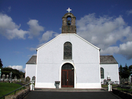
Detached three-bay double-height Catholic church, c.1840, on a cruciform plan comprising two-bay double-height nave with single-bay double-height transepts to north-west and to south-east, and single-bay double-height shallow chancel to north-east extending into single-bay single-storey sacristy with half-attic. Extensively renovated and reordered, c.1965. Pitched roof on a cruciform plan with replacement artificial slate, c.1965, clay ridge tiles, cut-stone bellcote to gable to south-west (with cast-iron bell, stringcourse, archivolt over with cut-stone voussoirs, and wrought iron cross finial), and cast-iron rainwater goods on rendered eaves. Painted replacement roughcast walls, c.1965, with rendered strips to corners. Round-headed window openings with replacement concrete sills, c.1965, and fixed-pane leaded stained glass windows. Round-headed door opening with painted red brick surround, replacement glazed timber double doors, c.1965, and overlight having leaded stained glass panels. Full-height interior reordered, c.1965, with glazed timber internal porch, carved timber pews, timber panelled galleries to first floor to transepts on polygonal pillars, and carved alabaster/marble altar fittings. Set back from road in own grounds with tarmacadam forecourt. (ii) Graveyard to site with various cut-stone grave markers, c.1840 – present.
This official record and map point do not grant access. Most recorded buildings are privately owned; view them only from public ground unless the owner allows entry.